|
| Welcome to
Sundials of the World! CANADA
|
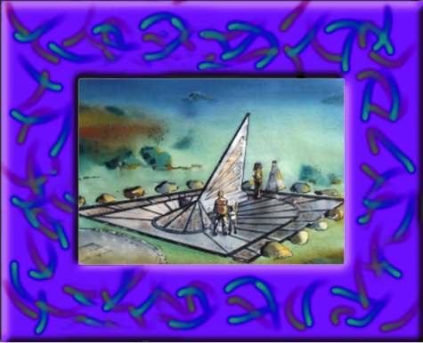
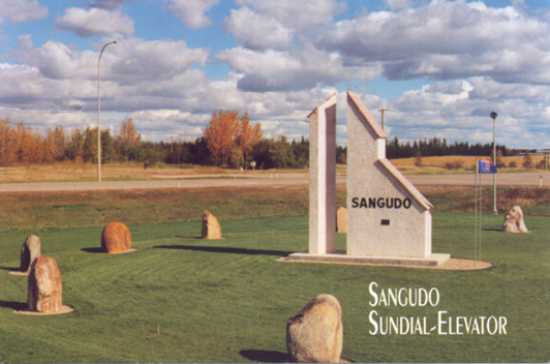
The horizontal sundial
presented on this page is located at the entrance of the Village of
Sangudo, Alberta. The dial is located at latitude 54°54' N and is
designed to show local apparent time. The sundial has been registered
as the official logo of the Village of Sangudo.
The
photograph is a post card of the sundial and the following are excerpts
taken from the Sangudo Sundial-Elevator brochure. This information was provided by
Pamela Nelson who is the village's Chief Administrative Officer. For
additional information please visit: www.gov.sangudo.ab.ca/page6.html.
This is a really
great sundial! It captures the essence of one of the fastest
disappearing symbols of the prairie provinces - the country grain
elevator. What was once a common site in Manitoba, Saskatchewan
and Alberta is now an endangered species.
|
The Sangudo Sundial-Elevator
is one of the biggest sundials in existence with a height of
21 feet and a total weight of over 40 tons, including the
marker rocks. The design provides for a modern sculptured
appearance of a country grain elevator with a shingled roof, permanency
(100 year range), and simplicity and economy of construction
utilizing local volunteer craftsmen. The design is indeed
unique and has been officially copyrighted by the Village of
Sangudo.
The
design incorporates an additional feature which makes it
particular to the Village of Sangudo. The angle of the upper
roof slope is 54°54',
which corresponds with the north latitude of Sangudo, and as
such, enables the structure to function as a simple sundial.
The combination of structural design and the time it tells (Sangudo
Solar Time) makes the "Sundial Elevator" a unique
structure, world wide.
The
large boulders were found in farm fields near Sangudo, having
been deposited there during the last great glaciation as the
Laurentide Ice Sheet moved from the northeast during the
period 22,000 to 12,000 years ago. The three classes of rocks:
sedimentary, igneous and metamorphic are represented in this
collection. The boulders range in age and place of origin from
Precambrian Shield granite (about two billion years old) from
the Fort Smith, Northwest Territories area to Cretaceous
sandstones (about 70 million years old) formed locally in the
Pembina River basin.
|
|

Erection
of the landmark was a community effort sponsored by the
Sangudo Chamber of Commerce in conjunction with the Village of
Sangudo. Over 70 volunteers and donators have been recognized
for their support of this project.
|
|
WHAT
THE SUNDIAL WILL TELL YOU
-
Local
Solar Time estimate, Solar Noon
-
Major
Calendar Functions: Longest Day, Shortest Day, Equinoxes
-
Geographical
Information: Exact Latitude, Longitude, Elevation, True
North direction
On
the average, Sangudo Solar Time is about 40 minutes behind MST
or 1 hour and 40 minutes behind MDT.
Reading
the Sundial: Locate the shadow cast by either the west
edge (A.M.) or east edge (P.M.) of the upper roof only. If the
shadow falls well outside the range of the marker rocks, line
the shadow with either the A.M. or P.M. sundial centers (base
of the flag poles).
Observing
Solar Noon: Solar Noon is based on determination of the
high point of the sun as it arcs across the sky. The Sangudo
Sundial-Elevator incorporates an additional feature to more
precisely identify solar noon. The small stylus on the center
of the shadow-casting roof identifies the sun's high point
when the pointer's shadow crosses the leading edge of the
marker structure.
Reading
Calendar Functions: The calendar functions listed can be
observed as marked on the upper west face of the marker
structure. Correct shadow observation can only be made at
solar noon.
|
 |
|

